Growing a citrus data bank

MORE than 750 citrus farms across the country have been carefully mapped and included on a new National Citrus Map.

Created by the University of New England’s Applied Agricultural Remote Sensing Centre (AARSC), the map serves as a national baseline for the location of all commercial citrus orchards across Australia.

The map can be viewed on the Citrus Australia website, citrusaustralia.com.au.

CA says the map, developed to support traceability, value-adds essential information at greater detail (block level).

This information is not available in the Australian Tree Crop Map and is only accessible via CA.

The National Citrus Map provides a pioneering fundamental data set for Australian citrus that is expected to become the cornerstone of the industry’s traceability, biosecurity, exports, sustainability and business planning.

CA and the AARSC have developed the map, which adds more detailed information to the existing citrus elements of the Australian Tree Crop Map, including block ID, variety and age.

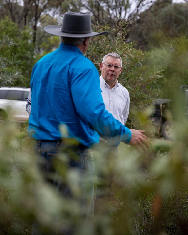
It also employed citrus traceability officer Paul Stephens to gather additional data to populate the map.

CA chief executive Nathan Hancock says “digitising the mapping will help improve the traceability to farm for biosecurity and food fraud-related issues”.

“It also provides an accurate assessment of current and future crop loads, which will aid future market development, and make KCT applications easier for growers,” Nathan says.

“The risks to industry if this tool is not developed and maintained are jeopardised traceability and biosecurity.”

Development of the National Citrus Map, together with complementary projects for isotope testing and implementation of new traceability systems for exports, was achieved through the Citrus Export Development Project, funded by Agriculture Victoria’s food-to-market program.

Growers can access the Australian Tree Crop Map on the CA website and can search for their farm by co-ordinates or road name.

Farmers can contact CA if they want the map updated.

“We are proud to be breaking new ground with this initiative, but equally, it would be negligent not to do so,” Nathan says.

About 750 farms have been mapped and 400 more are on the list.

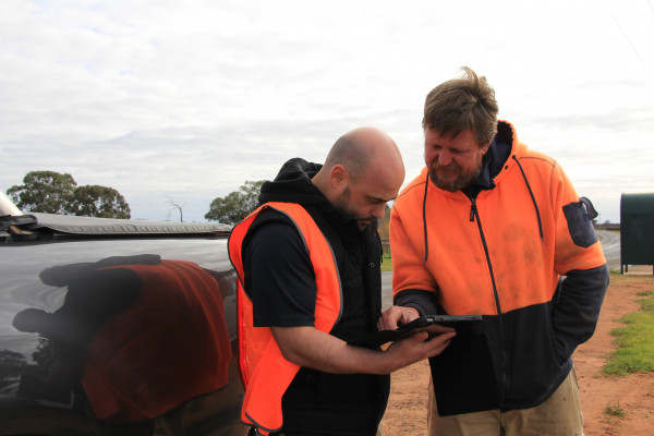
Under the program, data is populated at block level into the map by CA through a purpose-built application developed by AARSC, supported by an iPad application that can be used on farm, enabling future use by CA, especially during the yearly November-January Citrus Tree Census.

All information populated in the National Citrus Map is owned by Citrus Australia and is secure under strict sign-in access.

Digital Editions


  • Almond boss resigns

    Almond boss resigns

    ALMOND giant Select Harvests is on the hunt for a new boss after shock news its chief executive is stepping down. Chief executive and managing…

More News

  • Dog’s Day Out arrives in the Mallee

    Dog’s Day Out arrives in the Mallee

    THE iconic spluttering rumble of Lanz Bulldog Tractors is set to roar across Swan Hill and Woorinen next month, when the Mallee Steam, Oil and Machinery Club hosts Dog’s Day…

  • Perfect storm for grape industry

    Perfect storm for grape industry

    This year is certainly testing ones resolve, excessive heat, high water costs, record low grape prices, 170mm of rain at the wrong time and now the fuel issue. After eventually…

  • Holding on to their heritage

    Holding on to their heritage

    Purchase this photo from Pic Store: 531373 TRADITIONAL family farms, passed down from generation to generation, are becoming rarer and rarer these days. With the growth in corporate farming, greater…

  • Wet weather halts harvest

    Wet weather halts harvest

    It’s been an eventful start to harvest for the almond industry. Like all of agriculture in the region, Mother Nature and geo-political tensions have played a hand in providing extra…

  • Royal Commission push back

    Royal Commission push back

    A FIERY clash in Federal Parliament has reignited the bitter fight over the future of the Murray-Darling Basin, with the federal environment minister rejecting claims the government is “destroying family…

  • Call for royal commission into water welcomed by irrigators

    Call for royal commission into water welcomed by irrigators

    FARMING communities have backed a call for a federal Royal Commission into water, saying it is time to expose the “treachery, lies and shonky deals” behind the Murray-Darling Basin Plan.…

  • Nationals push to protect prime farmland with new federal Bill

    Nationals push to protect prime farmland with new federal Bill

    THE Nationals have moved to block taxpayer funding for energy and mining projects on Australia’s best farming land, unveiling a new Bill they say is vital to protect the nation’s…

  • Sally returns from Japanese adventure

    Sally returns from Japanese adventure

    I am pretty excited for this week , actually just tomorrow evening specifically when Sally returns from her first globe trotting adventure. Flying in from Osaka Japan, she’s been on…

  • CWA brings life skills program to the Mallee

    CWA brings life skills program to the Mallee

    Purchase this photo from Pic Store: 539453 A SURGE of community spirit swept through the Mallee when Country Women’s Association of Victoria president Jenny Nola attended the Murray Valley Conference…

  • Basin leaders meet as water plan review looms

    Basin leaders meet as water plan review looms

    NEARLY 200 leaders from across the Murray-Darling Basin gathered in Brisbane last week to debate the future of water management, with northern Victorian councils warning food production and regional communities…